
The Barossa Subsea Infrastructure Installation Environment Plan (Revision 2) (SURF EP) was accepted by NOPSEMA in February 2024. A copy of the accepted SURF EP is available online at NOPSEMA’s website.
Activity summary
In accordance with the accepted SURF EP, Santos commenced the Subsea Infrastructure (SURF) installation activities in February 2024. The SURF EP provides for the Barossa SURF and moorings installation and pre-commissioning activities, which comprise the key infrastructure shown in Figure 1. The SURF and moorings infrastructure has been designed to support the connection of six subsea production wells to the Floating Production Storage and Offloading vessel (FPSO). Drilling of the wells, and use of the FPSO, are dealt with under separate Environmental Plans.
The SURF and moorings installation and pre-commissioning campaign (SURF campaign) will be undertaken within Commonwealth waters within the boundaries of Commonwealth Petroleum Production Licence NT/L1, which is approximately 300 kilometres north-north-west of Darwin in the Northern Territory. The operational area is approximately 140 kilometres north of the Tiwi Islands (Figure 2).
The total duration of the SURF campaign is estimated to be approximately twelve months, subject to factors including vessel availability, operational efficiencies and weather conditions.
The preservation phase commences on completion of installation of key infrastructure and pre-commissioning activities. The preservation phase is designed to maintain the integrity of the infrastructure. The preservation phase for the subsea infrastructure will last up until commissioning, i.e. upon the commencement of activities under the Barossa Production Operations Environmental Plan.
The operational area covered under the SURF EP is the area within which all planned activities will occur. The operational area is defined as approximately 10 kilometres by 13.5 kilometres. Figure 2 shows the proposed location and operational area of the SURF and moorings infrastructure.
Activity vessels and helicopters within the operational area are considered part of the activity under the SURF EP.
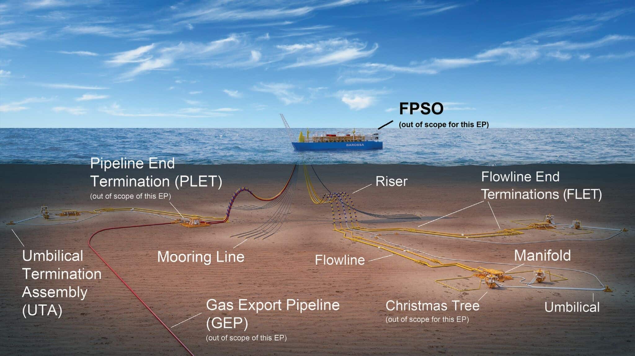
Figure 1: Graphical representation of the Barossa field layout
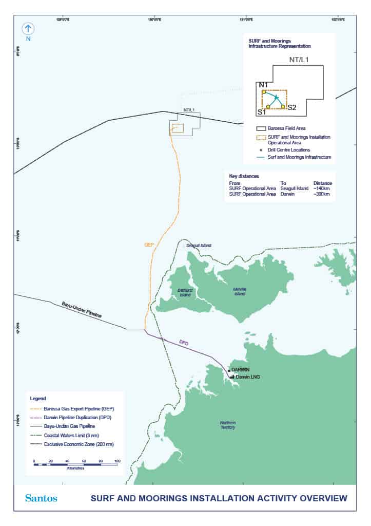
Figure 2: SURF and moorings installation operational area
Relevant links
- NOPSEMA Environment plan content requirements
- NOPSEMA Environment plan consultation requirements
- Offshore Petroleum and Greenhouse Gas Storage (Environment) Regulations 2023
- Barossa Offshore Project Proposal
- Barossa Offshore Project proposal appendices
- Barossa LNG Glossary
- Santos Barossa Subsea Infrastructure Installation and Pre-commissioning Activity Information Booklet